Topografie NL
Learn the topography of the Netherlands, province by province, for groep 6 of Dutch primary school.
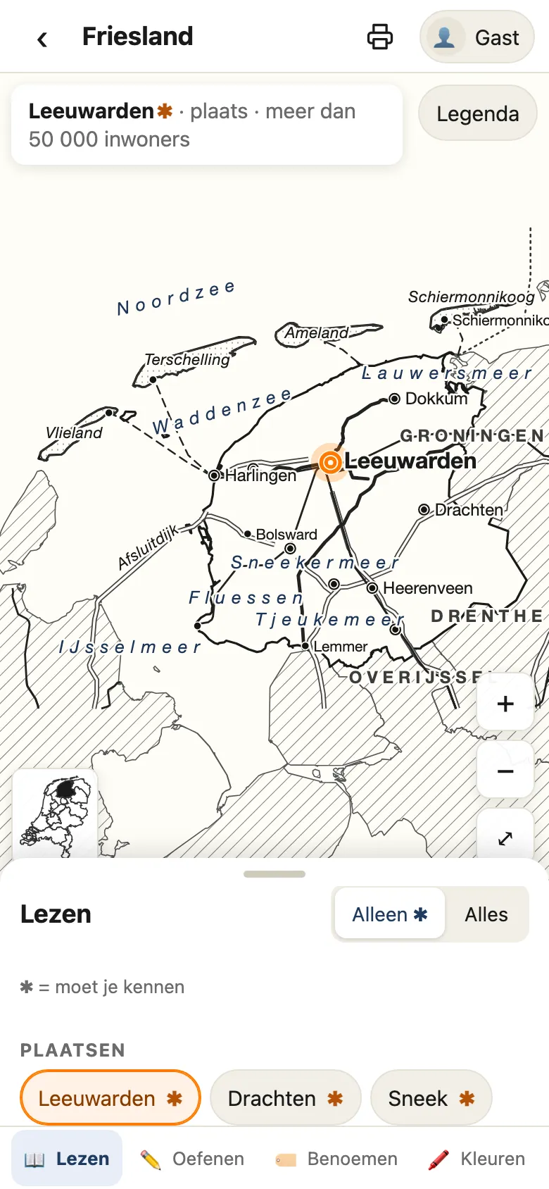
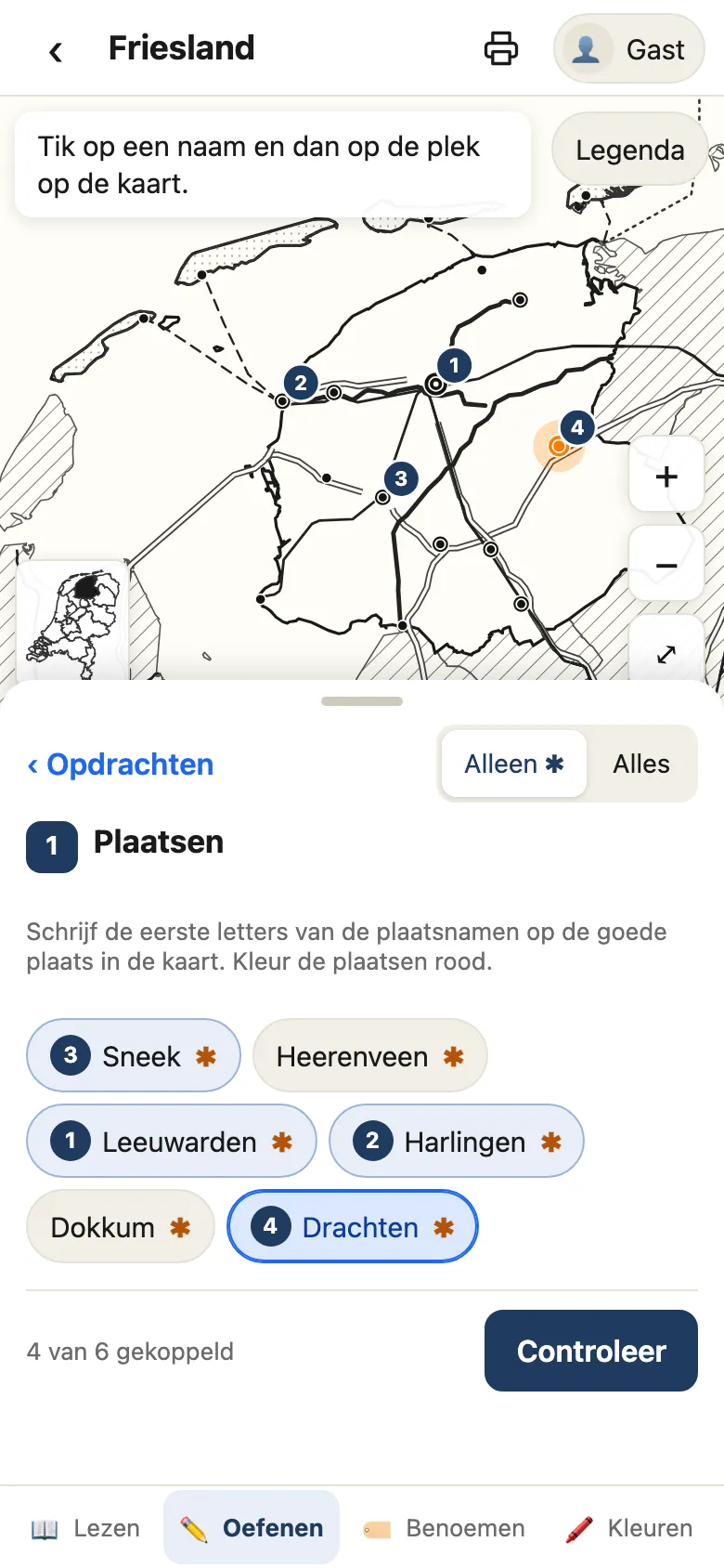
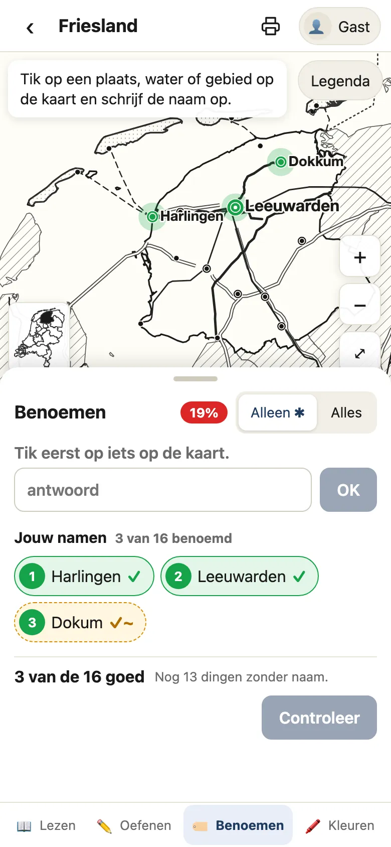
Topografie NL is a free web app for learning the topography of the Netherlands, made for children in groep 6 of Dutch primary school (ages 9 to 10). It goes province by province: explore the map, learn the names of the towns, waters, islands and regions, and check what you know. It runs at topografie.anna.amsterdam on a phone, a tablet or a computer, and its interface is in Dutch, like the lessons it follows.
It works the way a topography workbook does, with a map of each province, a list of names to learn and exercises. The difference is that the map responds: tap a name and it shows you where the place is.
Four ways to learn a province
Pick a province on the map of the Netherlands, and it opens in four modes:
- Lezen (read): the map with all its names. Tap a name and the place lights up on the map; tap a place and its name lights up in the list.
- Oefenen (practice): exercises like the ones in the workbook. Match names to places on a blank map and tap Controleer (check), or answer questions such as “Which towns lie along the Van Harinxma Canal?”
- Benoemen (name): the map without any names. Tap a town, a lake, a canal or an area and type its name. A wrong answer is explained (“Harlingen is a town, but this is a canal”), and you can try again.
- Kleuren (color): color the towns, waters, roads and areas, and write on the map, like with colored pencils on a worksheet.
Made for groep 6
All twelve provinces are in, with more than 400 names and about 90 exercises. An asterisk (✱) marks the 199 names a child must know, and a toggle shows either those or all of them. Exercises come in three levels: basic and follow-up ones count toward the province’s score, and extra ones are optional and earn a star (★).
The app checks topography, not spelling: an answer with a small typo still counts, and the right spelling is shown next to it. When the answers should come in a certain order, another order still counts, and the right order is shown. An exercise done with at most one mistake ends with confetti and fireworks. On the home screen, each province is colored by its exercise score, so a child sees at a glance which ones still need work.
Print it on paper
Every page prints on A4, with the whole map, its legend, and lines for a name and a date. The practice page prints as a worksheet: a blank map with numbers for the places and letters for the rest, every exercise with boxes to fill in or lines to write on, and the answers on the last page. A single exercise prints with its answers small and upside down at the bottom.
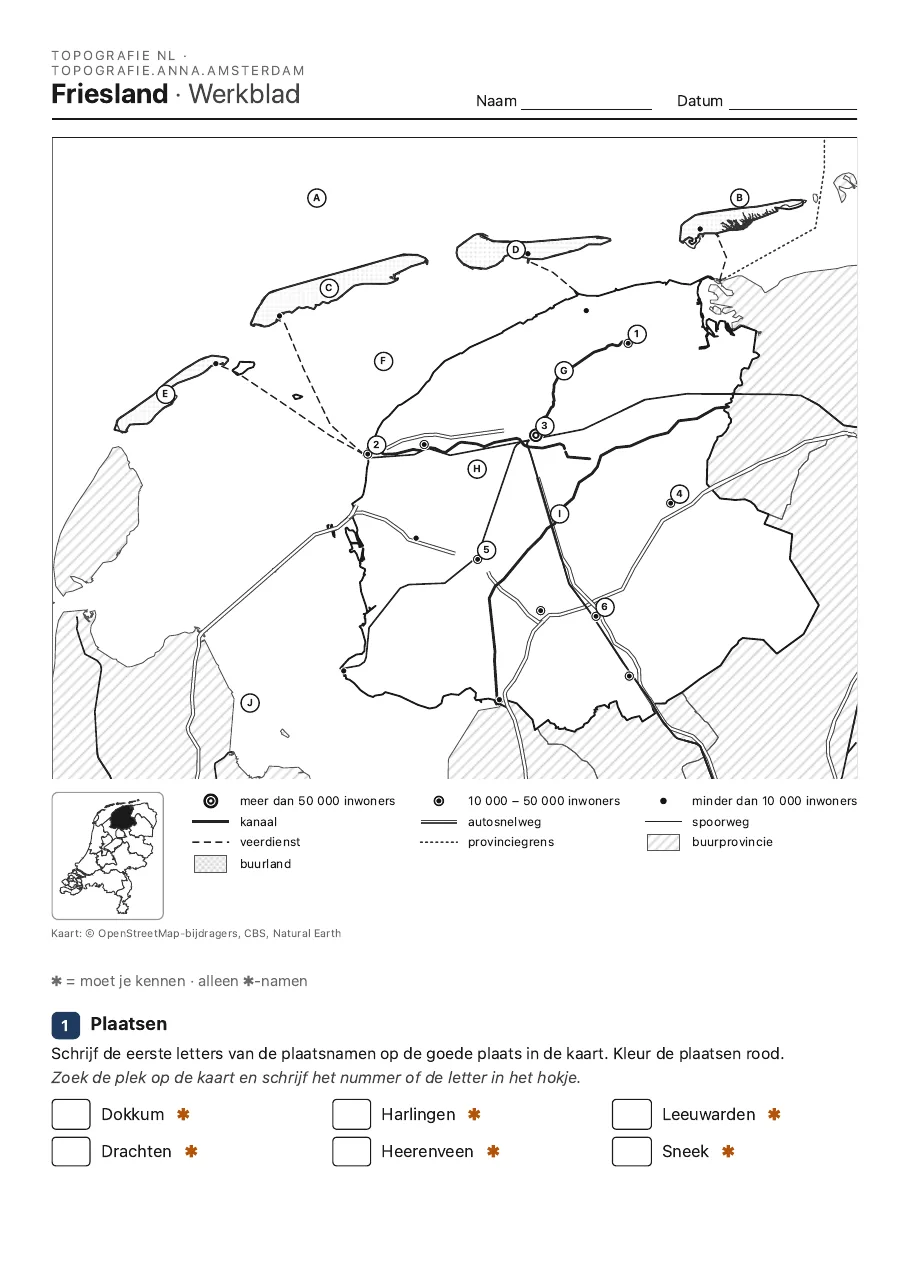
Printing from Lezen gives the map with its names, from Kleuren the child’s own colored map, and from the home screen an overview of the progress in every province.
On a phone or tablet, even offline
It’s made for children’s hands on phones and tablets: large buttons, and a map you drag and pinch to zoom. Add it to the home screen (on an iPhone or iPad: Share → Add to Home Screen), and it opens like an app.
After the first visit, the app and the maps of all the provinces are stored on the device, so practicing works without an internet connection, in the car or on vacation. Results from offline practice stay on the device and are sent once the connection is back.
There are no accounts and no passwords. Each device starts as a guest (Gast); a child types a name, and their progress is saved on the server under that name. To continue on another device, tap 📱 next to the name and scan the QR code with the other device. Adding a name and linking a device need an internet connection.
Maps from OpenStreetMap
The maps are built from real geographic data: the towns, waters, roads and railways from OpenStreetMap (via Geofabrik), the province borders from CBS, and Germany and Belgium from Natural Earth. Some seas, lakes and regions are drawn by hand. The maps look like the ones in a workbook, with symbols for towns by size, highways, railways, rivers, canals and ferries, a legend, and a small map that shows where the province lies in the Netherlands. They are vector graphics, so they stay sharp at any zoom level and on paper.